
Fani was the heaviest cyclone passing across northeast India for the past twenty years. With several large ports in the area, ships massively sought refuge at sea to avoid the worst of it using weather routing.
Fani was a category 4 hurricane on the Saffir-Simpson Scale and made landfall on 3 May and caused a trail of destruction and at least 41 casualties.
Ships Flee to Open Sea
Several large ports are situated in the area where Fani hit. These ports contribute strongly to the thriving economy of India. When tropical phenomena like Fani pass across these ports, the best tactic for vessels is to seek the open space of the ocean if possible, to avoid wind speeds of up to 240 km/hour (130 knots).
Mooring lines are likely to fail in these conditions with high risk of significant damages in ports. Anchors are also likely to drag, not able to withstand the extreme conditions.
This exodus of ships from Indian ports when Fani was drawing close was quite clearly demonstrated on the Marine Traffic website, which displays real time ship positions.
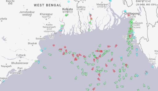
With courtesy of the Marine Traffic website, 3 May, 08:00 UTC.
Weather Routing Assistance
Some vessels are assisted by weather routing companies in these conditions, which enables masters to make carefully evaluated decisions on which actions to take to avoid a close encounter with weather systems such as Fani.
The situation below concerns a product tanker that was underway from the Persian Gulf to the port of Haldia, a major port close to the metropole of Kolkata.
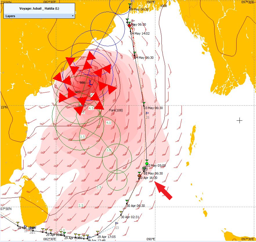
Situation 2 May, 06:00 UTC, the position of the vessel is indicated by the red arrow.
Initially, the vessel would overtake Fani and arrive at port shortly before Fani would hit land. The vessel was advised to maintain position south of Fani and only continue to Haldia behind the system, arriving at Haldia while Fani was dissolving over land.
In the port of Paradip, the master of a bulk carrier decided to leave port and let Fani pass while keeping safe distance at sea in the Bay of Bengal. On 3 May, the vessel was well out at sea and requested advice on how Fani was expected to continue and if the vessel could head for Paradip again.
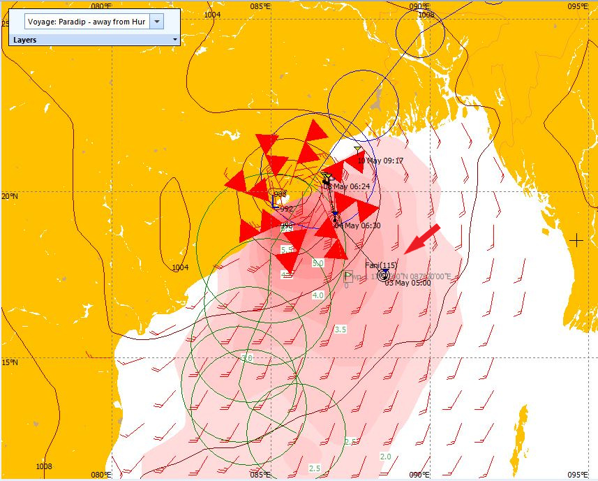
Situation 3 May, 06:00 UTC, the position of the vessel is indicated by the red arrow.
Even though the vessel was well clear of Fani, still it experienced southerly winds of force 8 for a while.
Timely Evacuation on Land
Due to timely actions from the local government, over one million people were evacuated from this densely populated area before Fani hit it. The United Nations praised the government for its quick response on the imminent threat Fani was.
The last time that a severe cyclone of a similar magnitude hit India, back in 1999, it took over 10,000 lives. Thanks to campaigns on awareness and evacuation tactics amongst the population and improved forecasting and warning systems such huge numbers of casualties could be prevented.
Timely information and in-depth knowledge on tropical cyclones are of crucial importance in avoiding severe damage and casualties.
Article by Remko Vermeer, Master Mariner at MeteoGroup and Grieta Spannenburg, Marketeer at MeteoGroup
![]()
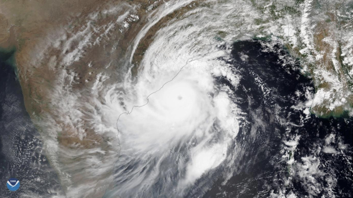
Picture (top): Satellite image of Fani, Thursday 2 May, before making landfall (with courtesy of NOAA Environmental Visualization Laboratory).